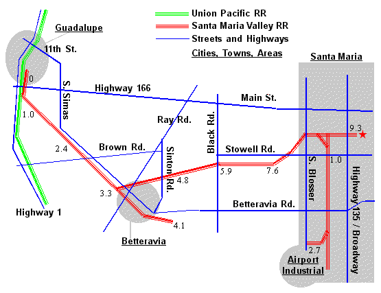
The red star marks the location of the yard, the eastern-most point of operation for today's SMVRR. The numbers on this map mark rail mileage from Guadalupe - see details and Yahoo map links below.
For further detail, use the Yahoo map links below. Keep the zoom level to 3 or less and the railroad will be shown as "++++++" (except where it runs down the middle of a street).
West to East from Guadalupe
0.0 Guadalupe: interchange with the Union Pacific RR [Yahoo map]
2.4 Bragur Siding
3.3 Betteravia Junction (sugar mill location) [Yahoo map]
4.1 Betteravia Stock and Betteravia Stock Pass (where the feedlots were)
4.8 Carr Siding (Greka Energy operates a refinery here)
5.9 Pacer [Yahoo map]
7.6 Bell Siding
9.3 Depot, Yard, and SMVRR Headquarters [Yahoo map]